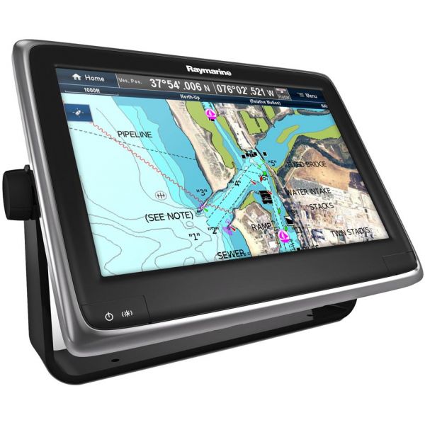
Raymarine E70235-US a125 12.1in Wi-Fi MFD w/ C-MAP US Lake & Coastal Charts
Our Best Offers
Free Economy Shipping on Orders over $100 with NO CODE NECESSARY! (Some Exclusions Apply)
Current Active Promotions
| Model TD Code | Description | Chart Included | Price |
| E70235-US RAY-0721 | a125 12'' Multifunction Display with Wi-Fi | C-MAP US Lake & Coastal Charts | $2,599.99 USD | ||||||||
The Raymarine a125 Wi-Fi Multifunction Touch Display features a super-bright 12.1 in. LCD screen with multitouch pinch-to-zoom control and excellent sunlight visibility. This full featured GPS and chartplotter with Raymarine's LightHouse II user interface is compatible with both C-Map 4D and Navionics charts.
The capabilities of the Raymarine a125 can be expanded by connecting other Raymarine accessories, MFDs thermal cameras, sonar, radar, weather receivers, instruments, engines, and Evolution autopilots, through the a125's dual RayNet network ports, or SeaTalkng/NMEA2000 compatibility.
Raymarine E70235-US a125 Features:
- Raymarine's most advanced chartplotter engine
- Multitouch pinch-to-zoom
- Built-in, 50-channel, 10 Hz GPS delivers fast and smooth vessel tracking
- Wi-Fi and Bluetooth wireless networking built-in
- Play and control MP3 audio on your smartphone remotely with Bluetooth
- Sync with the Navionics Boating app to exchange navigation data and update charts
- Navionics Plotter Sync bridges routes and waypoints between your aSeries and your tablet or smartphone
- Standard composite video input port suitable for marine cameras or Raymarine Thermal Night Vision cameras
- Choose fixed mount or pan/tilt/zoom thermal camera models
- Slew-to-Cue camera integration with AIS and Radar target
- Connect multiple IP video cameras
- GPS and Russian EGNOS support provides faster acquisition and improved accuracy
- WAAS and EGNOS Satellite Based Augmentation System (SBAS) support for satellite differential corrections
- Optional external GA150 antenna (not included) for challenging below-deck applications
- Dual-slot MicroSD card reader with support for Raymarine LightHouse, C-Map 4D, and Navionics charts
- Includes US Lakes and Coastal chart bundle with over 12,900 US Lakes (over 1,900 high-definition)
- Coastal navigation data includes all critical chart objects and navigation aids, with spot soundings and contours out to 60ft or 20m
- Coastal data does not include Currents, Tides, or C-Marina port database. The high-definition lakes data delivers 3 ft. contour intervals or better
- Compatible with C-Map 4D Navionics+, Silver, Gold, Platinum+, HotMaps and HotMaps+ charts
- Free regular updates with new features and enhancements
- Includes:
- Flexible Suncover
- Power/data/video cable (1.5 meters)
- Trunnion bracket kit
- Flush mount kit
- Front trim bezel kit
- SeaTalkng to Device Net Adapter (for connection to NMEA2000 networks)
- SeaTalkng Spur Cable (1m)
- RayNet to RayNet Interface Cable (2m)
Show off your fishing gear investment. Please post images and videos of your fishing gear, apparel, catches and lifestyle shots on and off the water. Let's see what you've got for a chance to win FREE gear! You can use #HookedOnTD or UPLOAD YOUR IMAGE HERE to make it onto our product pages or gallery. See something you like? You can shop directly from the images we post when gear we sell is featured!


