Our Best Offers
Free Economy Shipping on Orders over $100 with NO CODE NECESSARY! (Some Exclusions Apply)
Current Active Promotions
| Model TD Code | Description | Size | Touchscreen | Transducer Type | CHIRP DownVision | Dual Channel Sonar | Cartography | Price |
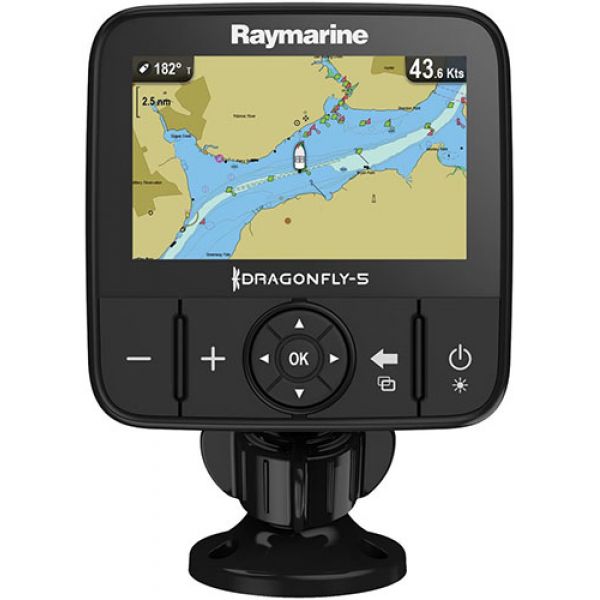
| E70295-US RAY-0641 | Dragonfly 5M | 5'' | No | - | No | No | C-Map | $369.99 USD | |||
Dragonfly 5M GPS is ready to get you on track with a fast 50-channel GPS and the super-easy Dragonfly user interface. With Dragonfly 5M, there is no waiting for charts to load. A fast processor makes panning, zooming, and exploring maps simple and fun. Dragonfly's all-weather, high-definition color LCD display makes maps come to life and optical bonding protects the display from internal fogging.
Superior Fishing Electronics Made Incredibly Simple
Change your underwater view and catch more fish with the Dragonfly 5M wide-spectrum CHIRP DownVision technology. Easily identify fish and underwater objects with photo-like sonar images. Dragonfly's all-weather, high-definition color LCD display looks sharp from every angle. Step up to a smarter species of sonar with Dragonfly.
The Dragonfly Difference
A leap into the future of sonar, Dragonfly sonars employ true wide spectrum CHIRP technology. With wide spectrum CHIRP more sonar signals are transmitted into the water, allowing Dragonfly to interpret more detail, target more fish, and image structure with unmatched clarity.
- 5" All-weather, high-definition LED backlit display
- Optically bonded display for sharp color, wide viewing angles and no internal fogging
- Precision guidance using a 50-channel fast acquistion internal GPS sensor
- Simple to use - Power on and become a dragonfly expert in minutes
- Ball and socket tilt swivel mount lets you mount Dragonfly easlily on any surface
- Removable mounting ball is compatible with aftermarket ball and socket
mounting systems for more mounting options - MicroSD memory card reader
- Includes US lakes, rivers, and coastal maps by C-MAP
- Compatible with optional Navionics and Raymarine Lighthouse format charts
- Internal storage for 3000 waypoints and 15 tracks. Use optional mciroSD memory cards for expanded storage
Show off your fishing gear investment. Please post images and videos of your fishing gear, apparel, catches and lifestyle shots on and off the water. Let's see what you've got for a chance to win FREE gear! You can use #HookedOnTD or UPLOAD YOUR IMAGE HERE to make it onto our product pages or gallery. See something you like? You can shop directly from the images we post when gear we sell is featured!


