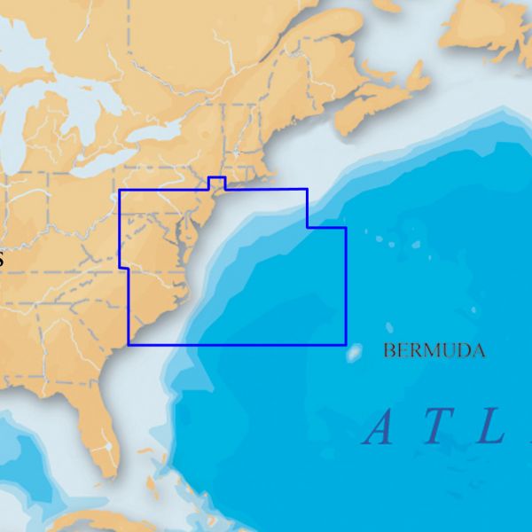
Navionics Platinum+ U.S. Mid Atlantic & Canyons CF Card
Electronic charts are NOT returnable. When ordering, please write in the comments field the type of GPS unit you will be using this item with. This is to ensure that you are ordering a compatible chart.">
Our Best Offers
Free Economy Shipping on Orders over $100 with NO CODE NECESSARY! (Some Exclusions Apply)
Current Active Promotions
| Model TD Code | Description | Price |
| CF/905P+ NVN-0117 | Navionics Platinum+ U.S. Mid Atlantic & Canyons CF Card | $349.95 USD | |||||||||
The Navionics Platinum+ U.S. Mid Atlantic & Canyons CF Card covers New Jersey, Delaware Bay, Chesapeake Bay, North Carolina, Bermuda, New York Harbor to Cape Romain, including Philadelphia, Norfolk and bathymetric details of all Mid-Atlantic Canyons. Multi-dimensional marine charts include comprehensive Nautical Chart, incredible fishing detail with SonarChart 1 ft HD bathymetry map, and Community Edits. Additionally, exclusive Platinum features take the boating experience to a whole new level: 3D view, high-resolution photo/chart overlay, port photos, and geo-referenced coast pilots. Register online for one year of daily updates to Nautical Chart, SonarChart and Community Edits.
- One Foot Contours Inshore and Nearshore
- 3ft and 6ft Contours Offshore Beyond 90ft
- 3D View
- Satellite Overlay
- Port Photos
- SonarChart
- Tides & Currents
- Safety Depth Contours, Navaids
- Coastal Points-Of-Interest
- Port Services Information
- Enhance SonarChart with sonar logs you collect using a plotter or mobile device.
Show off your fishing gear investment. Please post images and videos of your fishing gear, apparel, catches and lifestyle shots on and off the water. Let's see what you've got for a chance to win FREE gear! You can use #HookedOnTD or UPLOAD YOUR IMAGE HERE to make it onto our product pages or gallery. See something you like? You can shop directly from the images we post when gear we sell is featured!


