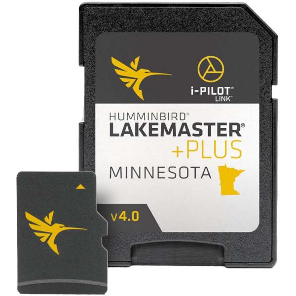
Humminbird 600021-10 LakeMaster Plus Chart - Minnesota w/ Lake of the Woods Rainy River - MicroSD/SD - Version 4
Our Best Offers
Free Economy Shipping on Orders over $100 with NO CODE NECESSARY! (Some Exclusions Apply)
Current Active Promotions
| Model TD Code | Description | Format | Coverage | Price |
| 600021-10 HUM-0753 | LakeMaster PLUS Chart | MicroSD/SD | Minnesota (v4) | $149.99 USD | |||||||
LakeMaster PLUS Minnesota V4 with Lake of the Woods & Rainy River
LakeMaster PLUS Minnesota V4 microSD Format Electronic Chart by Humminbird. The Humminbird LakeMaster Minnesota PLUS Edition micro map card has added over 1,000 new lakes, 81 High Definition - Surveyed waters to now boast contours for a total of over 3,200 lakes with more than 500 lake maps in High Definition. Newly surveyed waters in stunning HD include: MS River sections: Above Sartell Dam and from Little Falls to Brainerd plus Pool 4/Pepin, Crosby Mine Pit area lakes i.e. Pennington Chain, More Grand Rapids area lakes i.e. Surprise, and Johnson, More Park Rapids area lakes i.e. Bad Medicine, Spider, and Middle Crooked, More Alexandria area lakes i.e. Grant, Brophy, Oscar, and Red Rock plus many more!
Features:
- i-Pilot® Link™ compatible
- Easy to read contours
- Depth Highlight Range
- Water Level Offset
- Shallow Water Highlight
- Scrollable Lake List
PLUS has all of the features you've come to love from LakeMaster, but allows for aerial image overlay on High Definition waters. Now you have the ability to use quality aerial photography to view the entry and exits of creek channels, see how far a reef or weed line extends, pick out shallow water rock piles, steep drop-offs and other features of the lake you've been missing from traditional maps. LakeMaster PLUS gives you the freedom to choose how you want to use the aerial imagery.
- Aerial Only - This layer shows only aerial imagery and no other map information
- Aerial + LakeMaster Contours - This layer shows the colored LakeMaster map and the aerial imagery that extends around the body of water
- Aerial + Contours Only - This layer shows the aerial imagery and just the LakeMaster contours so you can still pick out those features in the water while still seeing your depth
Each map card Edition covers some of the most popular water bodies in the region and the PLUS series also gives you access to all of the LakeMaster features.
- Great detail, easy to use
- None
Show off your fishing gear investment. Please post images and videos of your fishing gear, apparel, catches and lifestyle shots on and off the water. Let's see what you've got for a chance to win FREE gear! You can use #HookedOnTD or UPLOAD YOUR IMAGE HERE to make it onto our product pages or gallery. See something you like? You can shop directly from the images we post when gear we sell is featured!


 WARNING: This product can expose you to chemicals including Naphthalene which is known to the State of California to cause cancer. -