Homeport Charts 6
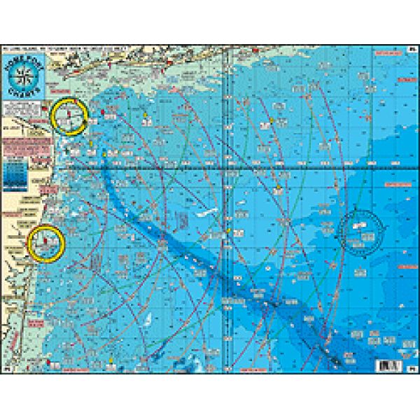
MUDHOLE CHART- LONG ISLAND NY to SANDY HOOK to GREAT EGG INLET
MUDHOLE CHART- LONG ISLAND NY to SANDY HOOK to GREAT EGG INLET
Our Best Offers
Free Economy Shipping on Orders over $100 with NO CODE NECESSARY! (Some Exclusions Apply)
Current Active Promotions
| Model TD Code | Type of Water | Features | Price |
| #6 CHA-0011 | Ocean/Inshore | Laminated - Waterproof Color coded depth and contour curve lines | $19.99 USD | ||||||||
Awesome Bottom Structure
Shows Sandy Hook , Shark River, Manasquan, Barnegat, Beach Haven, Atlantic City, Ocean City
Out 50 plus Miles
- Laminated- Waterproof
- 10 mile radius lines from each inlet
- Color coded depth and contour curve lines showing Holes, Shoals, Lumps, and Bumps
FISHING GROUNDS with DGPS LAT/LON Coordinates:Mud Hole, The Glory Hole, Chicken Canyon, Cholera Bank, Anglers Bank, Acid Waters, Shrewsbury Rocks, The Farms, Tarpon Lump, England Bank, Augie's Lump, Klondike Bank, Monster Ledge, Humpty Dumpty, Little Italy, Shark Ledge, Triple Wrecks, East Lump, Seaside Lump, Tolton Lump, Oleys Lump, ESS Ledge, North Hole, Dusky Hole, East Barnegat Ridge, The Star, Harvey Cedars Lump, Red Tower Lump, Hambone, Dog Lump, A.C. Ridge, Fingers, Table Top, Avalon Shoal, Margarita Lump, Sea Isle Ridge, The Cigar, Jim's Hole, 750 Square, Lemke's Canyon, Sea Isle Lump, Cuma Lumps, and many more.
DGPS NUMBERS FOR WRECKS: Lido, Navy Barge, Ocean Prince, Wolcott, Oregon, Bonanza, San Diego, Hilton Castle, Reggie, Light Ship Wreck, Linda, 3 Sisters, Bald Eagle, Eurreka, Happy Days, USS Tarantula, Goulandris II, Bendix, Gloria and Doris, Florence, Burnside, Brencen, Arundo II, Ednas Bottom, USCG Catamount, Somerstod, Anastasia, Cow Wreck, Maurice Tracy, Truro, Vixen, Hargraves, Tolten, Sea Hag, Resor, West Wreck, Lexington, Bidevind, Texas Tower, Chesapeake, San Saba, Brick Wreck, Huntington, Great Isaac, Spanish, Reliance, H. Ruse, Oklahoma, Skukas, Crystal Gayle, Gloria, Moran, Almirante, Astra, Teaser, Burrows, Oil Wreck, $25 Wreck, Blackie, San Hose, Cayru, Salem, Mud Wreck, Martino, New Rhodes, 28 Mile Wreck, Capt Walt. Hendee, Bass Barn, EB Cole, Kahuka, and many, many more.
Joins Charts:
- #2-Inshore Beach Haven to Cape May to Indian River DE
- #4-Canyons GPS and Loran; Tom's to Washington Canyons
- #7-Manasquan to Great Egg Inlet out 20 miles
- #34-Shrewsbury-Navesink-Metedeconk-Shark-Manasquan Rivers
- #42-Raritan Bay
- #16-Inshore Shark River Inlet to Barnegat Inlet
- #22 ICW Manasquan Inlet to Barnegat Bay to Manasquan Inlet
- #11 ICW Barnegat to Ocean City, NJ with the Mullica River
- #12 Canyon Chart ALL GPS Hudson to the S. Poorman's
- #20 ICW Atlantic City to Cape May with Great Egg Bay and River and Tucahoe River
- durable
- Exactly as described.
- None.
- Prepared by Local, Veteran Boat Captain who is familiar with waters and boater needs. Compact size is easy to store. Laminated.
- None
Show off your fishing gear investment. Please post images and videos of your fishing gear, apparel, catches and lifestyle shots on and off the water. Let's see what you've got for a chance to win FREE gear! You can use #HookedOnTD or UPLOAD YOUR IMAGE HERE to make it onto our product pages or gallery. See something you like? You can shop directly from the images we post when gear we sell is featured!


