Homeport Charts 2
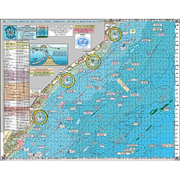
INSHORE BEACH HAVEN TO CAPE MAY, NJ TO BETHANY BEACH, DE
INSHORE BEACH HAVEN TO CAPE MAY, NJ TO BETHANY BEACH, DE
Our Best Offers
Free Economy Shipping on Orders over $100 with NO CODE NECESSARY! (Some Exclusions Apply)
Current Active Promotions
| Model TD Code | Type of Water | Features | Price |
| #2 CHA-0006 | Ocean/Inshore | Laminated - Waterproof Color coded depth and contour curve lines | $19.99 USD | ||||||||
Shows: Little Egg Inlet, Absecon Inlet, Great Egg Inlet, Corson's Inlet, Townsends Inlet, Hereford Inlet, Cape May Inlet in New Jersy to Indian River Inlet in Delaware
OUT 20+ miles with AWESOME BOTTOM STRUCTURE
186+ Wrecks and ReefsArtificial Reefs Sites: LITTLE EGG REEF- ATLANTIC CITY REEF- OCEAN CITY REEF- WILDWOOD REEF- CAPE MAY REEF- Updated DELAWARE REEF SITES...AND... the new Townsends Inlet Reef!
LOCAL KNOWLEDGE FISHING GROUNDS AND HOT SPOTS NOT FOUND ON OTHER CHARTS: Dog Lump, Hambone, AC Lobster Pots, Triple Lumps, Stone Beds, Cuma Lumps, Table Top, Peacock Lump, Old Grounds, The Valley, Cod Lump, NE Lump, Middle Lump, East Lump, Capt. Steve's Snags, PLUS Brigantine Shoal, Sea Isle Lump, Avalon Shoal, Stone Harbor Lumps, 5 Fathom Bank, Sea Isle Ridge, Fingers, 28 Mile Wreck, AC Ridge, Marylou Slough, South Shoal, Hens and Chickens Shoal, The Valley, McCries Shoal, Triple Wrecks, Fenwick Shoal.
WRECKS: Crystal Gayle, Glory Wreck, Russel, Moran, Astra, Swanaka, Blackie, Florida, Clam Boat, Mud Wreck, Salem, E.B. Cole, Dan's Wreck, Capt Walt Hendee, Bass Barn, D. Barrett, Show Barge, City of Athens, Poseidon, J.R. Williams, China Wreck, King Cobra, F.H. Beckwith, Marley, Sergeant, Tom Tracy, New Orleans, Southern Sword, Cherokee, Gun Boat, Bimbo, Moonstone, Hvoslef, Manhatten, Elizabeth Palmer, Hooter's Barge, Diana Graham, Ferry Elizabeth, Lydia, Guido's Tug, Bay Jack 55 Tug, Donna Star, Margie TTT
Joins Charts:
- Durable
- Waterproof
- Detailed
- None
- All the info I need for my northern boundary of local fishing.
- Prepared by Local, Veteran Boat Captain who is familiar with waters and boater needs. Compact size is easy to store. Laminated.
- None
Show off your fishing gear investment. Please post images and videos of your fishing gear, apparel, catches and lifestyle shots on and off the water. Let's see what you've got for a chance to win FREE gear! You can use #HookedOnTD or UPLOAD YOUR IMAGE HERE to make it onto our product pages or gallery. See something you like? You can shop directly from the images we post when gear we sell is featured!


