Our Best Offers
Free Economy Shipping on Orders over $100 with NO CODE NECESSARY! (Some Exclusions Apply)
Current Active Promotions
| Model TD Code | Description | Coverage | Price |
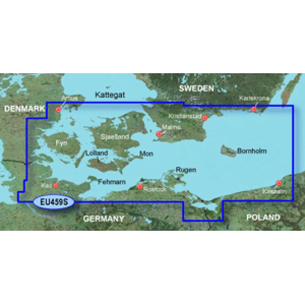
| HXEU459S GRM-1636 | BlueChart g2 | Swedish coast from Hoganas to Karlskrona, including Malmo Danish, German, and Polish coasts Arhus to Koszalin, including Sjaelland, Fyn, Mon, Falster, Lolland, Langeland, and Fehmarn | $139.99 USD | ||||||||
HXEU459S Covers:
Swedish coast: from Hoganas to Karlskrona, including Malmo. Danish, German, and Polish coasts: from Arhus to Koszalin, including Sjaelland, Fyn, Mon, Falster, Lolland, Langeland, and Fehmarn.
Garmin BlueChart g2 marine maps feature crisp labeling and an overall smoother presentation on your chartplotter display. In addition to the basic charts, tidal stations, currents, depth contours, IALA symbols and included fishing charts, BlueChart g2 offers improved transitioning between zoom levels and more seamless continuity across chart boundaries.
Customize Your Screens
BlueChart g2 also adds Safety Shading which allows the user to enable contour shading for all depth contours shallower than the user-defined safe depth. The fishing charts are designed to emphasize bathymetric contours with less visual clutter on the display. There's also a choice of standard 2-D direct overhead or 3-D "over-the-bow" map views for easier chart reading and orientation.
Features found on BlueChart g2:
- Seamless chart presentation
- Vector object orientated data
- Shaded depth contours and inter?tidal zones with spot soundings
- Port plans
- Tidal stations for selected countries
- Aids to navigation with view range and coverage including light sectors information
- Wrecks, restricted areas, anchorages, obstructions
- Tidal current graphs
- 2?D or 3?D map perspective view
- Marina points of interest and slipways
- Full bathymetric fishing charts providing detailed contours
BlueChart Compatibility
- BlueChart g2 on microSD/SD is recommended for: Colorado, Dakota, Oregon, nuvi 500 series; GPSMAP 60Cx/CSx, GPSMAP 76Cx/CSx, RINO 520HCx, 530HCx
- BlueChart g2 on Garmin data card is recommended for: GPSMAPs: 192, 198, 276C, 278, 292, 298, 376C, 378, 392, 398, 478, 492, 498, 2100 series, 2200 series, 3000 series
- BlueChart g2 on microSD/SD has limited compatibility (won't show BlueChart g2 Vision features) with: GPSMAPs: 400 series, 500 series, 600 series, 700 series, 4000 series, 5000 series, 6000 series, 7000 series
Show off your fishing gear investment. Please post images and videos of your fishing gear, apparel, catches and lifestyle shots on and off the water. Let's see what you've got for a chance to win FREE gear! You can use #HookedOnTD or UPLOAD YOUR IMAGE HERE to make it onto our product pages or gallery. See something you like? You can shop directly from the images we post when gear we sell is featured!


