Garmin Standard Mapping - Classic - microSD/SD Cards
Our Best Offers
Free Economy Shipping on Orders over $100 with NO CODE NECESSARY! (Some Exclusions Apply)
Current Active Promotions
| Model TD Code | Description | Price |
| 010-C1189-00 GRM-2622 | Standard Mapping - Emerald Coast - Classic - microSD/SD Card | $199.99 USD | |||||||||
| 010-C1195-00 GRM-2628 | Standard Mapping - Florida Keys - Classic - microSD/SD Card | $199.99 USD | |||||||||
| 010-C1198-00 GRM-2631 | Standard Mapping - Florida East Peninsula - Classic - microSD/SD Card | $199.99 USD | |||||||||
| 010-C1201-00 GRM-2634 | Standard Mapping - Florida West Peninsula - Classic - microSD/SD Card | $199.99 USD | |||||||||
| 010-C1192-00 GRM-2625 | Standard Mapping - Florida One - Classic - microSD/SD Card | $299.99 USD | |||||||||
| 010-C1186-00 GRM-2619 | Standard Mapping - Gulf Coast - Classic - microSD/SD Card | $299.99 USD | |||||||||
| 010-C1165-00 GRM-2598 | Standard Mapping - Louisiana East - Classic - microSD/SD card | $199.99 USD | |||||||||
| 010-C1168-00 GRM-2601 | Standard Mapping - Louisiana Central - Classic - microSD/SD Card | $199.99 USD | |||||||||
| 010-C1171-00 GRM-2604 | Standard Mapping - Louisiana West - Classic - microSD/SD Card | $199.99 USD | |||||||||
| 010-C1162-00 GRM-2595 | Standard Mapping - Louisiana One - Classic - microSD/SD card | $299.99 USD | |||||||||
| 010-C1183-00 GRM-2616 | Standard Mapping - Mississippi Sound - Classic - microSD/SD Card | $199.99 USD | |||||||||
| 010-C1180-00 GRM-2613 | Standard Mapping - Texas East - Classic - microSD/SD Card | $199.99 USD | |||||||||
| 010-C1177-00 GRM-2610 | Standard Mapping - Texas West - Classic - microSD/SD Card | $199.99 USD | |||||||||
| 010-C1174-00 GRM-2607 | Standard Mapping - Texas One - Classic - microSD/SD Card | $299.99 USD | |||||||||
Standard Mapping - Classic - microSD/SD Card
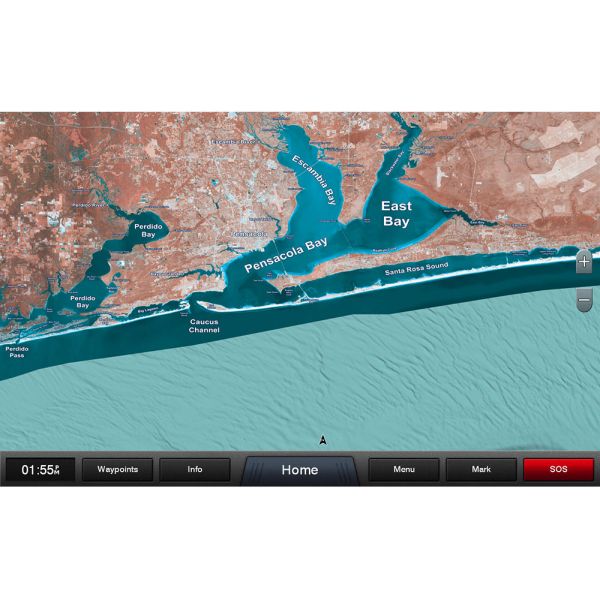
Statewide coastal aerial overlay provides high-resolution imagery and local names of waterways and land features.
High-resolution Aerial Imagery
Replaces the basemap so you can see every waterway and land feature.
High-definition Offshore Mapping
High-contrast offshore elevation shading allows you to easily see detail.
Local Names
Identifies local waterways and land features.
Show off your fishing gear investment. Please post images and videos of your fishing gear, apparel, catches and lifestyle shots on and off the water. Let's see what you've got for a chance to win FREE gear! You can use #HookedOnTD or UPLOAD YOUR IMAGE HERE to make it onto our product pages or gallery. See something you like? You can shop directly from the images we post when gear we sell is featured!


 WARNING: This product can expose you to chemicals which are known to the State of California to cause cancer, birth defects or other reproductive harm. -