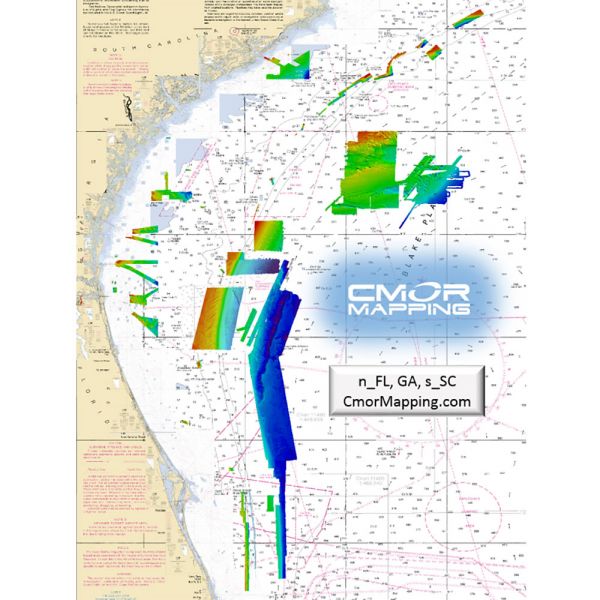
CMOR Mapping North Florida, Georgia & South Carolina Mapping
FREE 1 Day Shipping on All CMOR Mapping Products!
Our Best Offers
Free Economy Shipping on Orders over $100 with NO CODE NECESSARY! (Some Exclusions Apply)
Current Active Promotions
| Model TD Code | Description | Price |
| NEFL002R CMO-0029 | North Florida, Georgia & South Carolina Mapping - f/ Raymarine | $700.00 USD | |||||||||
| NEFL002S CMO-0028 | North Florida, Georgia & South Carolina Mapping - f/ Simrad, Lowrance, B&G & Mercury | $700.00 USD | |||||||||
North Florida, Georgia & South Carolina
This card replaces the North East Florida and Oculina/East Canaveral and now contains Georgia and the majority of South Carolina.
The North Florida, Georgia and South Carolina Card covers of some of the best fishing, diving, and deep dropping spots in the Atlantic Ocean.
A Few of the Areas Covered:
- 100 Fathom Curve (57nm ESE of Georgetown SC)
- Charleston Bump and many surrounding areas (swordfish mecca)
- Georgetown Hole (47nm SSE Georgetown SC)
- 100 / 400 area (59nm SE Little River Inlet, SC)
- Winyah Scarp (43nm SE Georgetown SC)
- “THE LEDGE” (47nm ESE Charleston SC)
- River Ledge 75ft depth (18.8nm SE Charleston SC)
- Charleston Natural Bottom 41-47ft depth (9nm SE Charleston Harbor)
- Charleston Shipping Channel
- Deep Drop / Swordfish Bottom 1331 to 1978ft 78nm SE Charleston SC
- Edisto Banks (50nm SE Edisto Island, SC)
- Southern Edisto Banks (8nm SW of Edisto Banks)
- The “DELI” (63nm SE of Hilton Head Island)
- Triple Ledge (66nm SE Savannah Georgia )
- Grays Reef Ledge 50-60ft depth (18nm SE Sapelo Sound GA)
- Natural Ledges Depths 60-65ft (18.5nm ESE St. Chatherines Sound)
- Anchor Ledge 75-82ft depth (26nm SE Ossabaw Sound)
- “GROUPER” ledges 120-128ft Depth (49nm East St. Simons)
- “KBY” Artificial Reef (9nm ENE Fernandina Beach, FL)
- SCAMP CITY 140-148ft depth (64nm East St. Mary's River)
- “FB” Natural Ledges (14nm ESE Fernandina Beach FL)
- Nassau Mud Humps (6nm E Nassau Sound)
- Jax Live Bottom 81-86ft deep (17nm E St. Johns River)
- Mayport Jetties and St. Johns River
- Pinnacles 1450 ft sand – 1351 ft top (43nm E Cape Canaveral)
The northern section of the original NEFL data starts due east of Fernandina Beach in an area locals call the R4 Navy Tower Bottom. Depths range from 100' to 2,200'.
The southern section of the original NEFL data starts east of Jacksonville. This section covers 941 square miles of data with depths ranging from 100' to 1,200'.
This is a must-have CMOR Card if you like to dive the secret ledges on the top of the break, bottom fish for snapper grouper on the ledge, troll for wahoo and other pelagics, deep drop for tiles and snowy grouper, or want to try daytime sword fishing in 1,500' of water.
CMOR Mapping bathymetry arms you with more and better data than anybody else on the water.
NOAA Charts are included in the background.
All CMOR Cards come on Micro SD cards with a standard SD adapter included.
Show off your fishing gear investment. Please post images and videos of your fishing gear, apparel, catches and lifestyle shots on and off the water. Let's see what you've got for a chance to win FREE gear! You can use #HookedOnTD or UPLOAD YOUR IMAGE HERE to make it onto our product pages or gallery. See something you like? You can shop directly from the images we post when gear we sell is featured!


