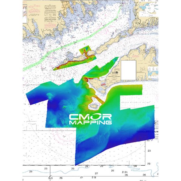
CMOR Mapping Long, Block Island Sound & Martha's Vineyard Mapping
FREE 1 Day Shipping on All CMOR Mapping Products!
Our Best Offers
Free Economy Shipping on Orders over $100 with NO CODE NECESSARY! (Some Exclusions Apply)
Current Active Promotions
| Model TD Code | Description | Price |
| LIMV001R CMO-0047 | Long, Block Island Sound & Martha's Vineyard Mapping - f/ Raymarine | $700.00 USD | |||||||||
| LIMV001S CMO-0046 | Long, Block Island Sound & Martha's Vineyard Mapping - f/ Simrad, Lowrance, B&G & Mercury | $700.00 USD | |||||||||
Long, Block Island Sound & Martha's Vineyard
This CMOR Card covers 2000 square miles of continuous, feature-rich bottom in Long, Block, Rhode Island Sound and Martha’s Vineyard. There are hundreds of shipwrecks, thousands of uncharted rocks, and countless ledges and mounds that hold the largest fish! The depths range from 1' to 385' in the deepest hole in the sound.
The coverage starts from Norwalk, CT on the NW corner to Eatons Neck on the SW corner and extends through the sound to east of Block Island.
The Long / Block Island Sound / Martha’s Vineyard CMOR card is the most complex and detailed chart ever created!
CMOR Mapping bathymetry arms you with more and better data than anybody else on the water.
NOAA Charts 12353, 12363, 13205, and 13218 are included in the background.
All CMOR Cards come on Micro SD cards with a standard SD adapter included.
Show off your fishing gear investment. Please post images and videos of your fishing gear, apparel, catches and lifestyle shots on and off the water. Let's see what you've got for a chance to win FREE gear! You can use #HookedOnTD or UPLOAD YOUR IMAGE HERE to make it onto our product pages or gallery. See something you like? You can shop directly from the images we post when gear we sell is featured!


