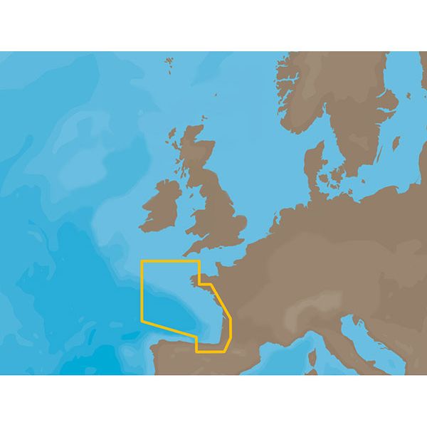
C-Map NT+ Electronic Marine Charts - France & Spain
Our Best Offers
Free Economy Shipping on Orders over $100 with NO CODE NECESSARY! (Some Exclusions Apply)
Current Active Promotions
| Model TD Code | Description | Coverage | Format | Price |
| EW-C203C-CARD CMP-0250 | C-Map NT+ Electronic Marine Chart | France Atlantic Coasts | C-Card | $295.99 USD | |||||||
| EW-C203FURUNOFP CMP-0352 | C-Map NT+ Electronic Marine Chart | France Atlantic Coasts | Furuno FP-Card | $295.99 USD | |||||||
| EW-C204C-CARD CMP-0251 | C-Map NT+ Electronic Marine Chart | Iberian Peninsula Atl Acores & Madeira | C-Card | $295.99 USD | |||||||
| EW-C204FURUNOFP CMP-0353 | C-Map NT+ Electronic Marine Chart | Iberian Peninsula Atl Acores Madeira | Furuno FP-Card | $295.99 USD | |||||||
| EW-C222C-CARD CMP-0259 | C-Map NT+ Electronic Marine Chart | France Rivers North | C-Card | $295.99 USD | |||||||
| EW-C222FURUNOFP CMP-0361 | C-Map NT+ Electronic Marine Chart | France Rivers North | Furuno FP-Card | $295.99 USD | |||||||
| EW-C223C-CARD CMP-0260 | C-Map NT+ Electronic Marine Chart | La Seine, Le Havre-Dijon | C-Card | $295.99 USD | |||||||
| EW-C223FURUNOFP CMP-0362 | C-Map NT+ Electronic Marine Chart | La Seine Le Havre-Dijon | Furuno FP-Card | $296.00 USD | |||||||
| EW-C146C-CARD CMP-0191 | C-Map NT+ Electronic Marine Chart | Isla Salvora-El Ferrol | C-Card | $200.99 USD | |||||||
| EW-C146FURUNOFP CMP-0316 | C-Map NT+ Electronic Marine Chart | Isla Salvora-El Ferrol | Furuno FP-Card | $200.99 USD | |||||||
| EM-C108C-CARD CMP-0226 | C-Map NT+ Electronic Marine Chart | Canal Du Midi | C-Card | $295.99 USD | |||||||
| EM-C108FURUNOFP CMP-0329 | C-Map NT+ Electronic Marine Chart | Canal Du Midi | Furuno FP-Card | $295.99 USD | |||||||
C-Map NT+ Electronic Marine Charts are the standard that ushered in contemporary digital charting. One of the most reliable chart options for boaters worldwide, NT+ charts continue to deliver exceptional quality and value to navigators worldwide. C-Map's classic line of electronic charts offers the same reliable navigation detail easy-to-use features you expect in all C-MAP by Jeppesen products.
C-MAP NT+ Key Features:
- Global coverage
- Rich detail and information
- Port and tide information
- Frequently updated chart data
- Easy on-screen query of all chart objects
- Compatible with PC-Planner – So you can plan a route and save it to your user card for use in your chartplotter.
- Windows 2000/XP32/XP64/Vista32/Vista64/Windows 7 32 bit/Windows 7 64 bit
- Pentium II or faster processor
- 128 MB RAM
- 50 MB available disk space
- Video resolution: 800x600 or higher
- Video colors: True-color, 32-bits
- DVD ROM Drive
- Internet Explorer 5.0 or higher
Show off your fishing gear investment. Please post images and videos of your fishing gear, apparel, catches and lifestyle shots on and off the water. Let's see what you've got for a chance to win FREE gear! You can use #HookedOnTD or UPLOAD YOUR IMAGE HERE to make it onto our product pages or gallery. See something you like? You can shop directly from the images we post when gear we sell is featured!


