Our Best Offers
Free Economy Shipping on Orders over $100 with NO CODE NECESSARY! (Some Exclusions Apply)
Current Active Promotions
| Model TD Code | Description | 3-D View | Aerial Photos | Port Plans | Coverage | Price |
| NA-N023 CMP-0397 | C-MAP MAX-N Electronic Chart | Yes | Yes | Yes | US Gulf of Mexico, Great Lakes & Rivers | $185.99 USD | |||||
Max-N Wide Cartography f/Lowrance, Simrad Yachting & B&G Chartplotters and Multifunction Displays
MAX-N Wide provides additional C-MAP features such as harbor, detailed marina charts and coverage of inland rivers and lakes. When you choose C-MAP you get the best charts, using the most reliable sources around the globe, from a company committed to safe navigation.
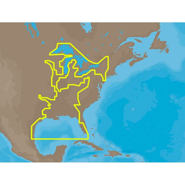
C-MAP MAX-N NA-N023 - US Gulf of Mexico, Great Lakes & Rivers Coverage:
Coverage of the Gulf states, starting from Boca Raton, FL, down to Key West, FL, then back up and around the Gulf to Brownsville, TX.
Also includes coverage of all the Great Lakes: Erie, Superior, Ontario, Huron and Michigan.
Coverage of the Great Lakes also includes Fox River and Lake Winnebago, Lake St. Clair and the Trent-Severn Waterway. River coverage includes the Mississippi River, Ohio River, Illinois River, Arkansas River, Red River, Ouachita River, Tennessee River, Cumberland River, Tenn-Tom Waterway and the Black Warrior River.
Other smaller rivers are also included: Green River, KY, Kanawha River, WV, Allegheny and Monongahela Rivers, PA and Kankakee River, IL.
Additional coverage of the Hudson River, including Lake Champlain, down to New York City, the Erie Barge Canal and partial coverage of the St. Lawrence River up to Montreal.
Max-N WIDE Feature List
- Anchorage Areas
- International and National Boundaries
- Anchorage Prohibited
- Military Practice areas
- Bottom Type
- Official up-to-date Chart sources
- Boundaries (fairways, channels, dredged areas, swept areas)
- Restricted, Caution, Fishing and Prohibited areas including Marine Protected Areas
- Bridges, overhead pipelines and cables with horizontal and vertical clearances
- Rocks
- Caution Notes
- Spot Soundings
- Coast & Drying Line
- Submarine Cables and Pipelines
- Depth Areas
- Traffic routing systems and separation schemes
- Depth Contours
- Wrecks, obstructions, offshore platforms, breakwaters, etc.
- Indication and details of all aids to navigation
- Detailed Marina Charts
C-MAP Max-N Wide products are compatible with the following products:
- HDS Gen1 (Min. Software Version: 4.1.36.68)
- Elite-7 HDI (Min. Software Version: 1.8.0.22784)
- NSS (Min. Software Version: 2.5-42.116-22312)
- Zeus Touch (Min. Software Version: 1.0-43.111)
Simrad NSE/NSO, B&G Zeus, Lowrance HDS Gen2/Gen2 Touch and Lowrance 4- and 5-inch Elite series products will become compatible with future software updates.
Show off your fishing gear investment. Please post images and videos of your fishing gear, apparel, catches and lifestyle shots on and off the water. Let's see what you've got for a chance to win FREE gear! You can use #HookedOnTD or UPLOAD YOUR IMAGE HERE to make it onto our product pages or gallery. See something you like? You can shop directly from the images we post when gear we sell is featured!


