Our Best Offers
Free Economy Shipping on Orders over $100 with NO CODE NECESSARY! (Some Exclusions Apply)
Current Active Promotions
| Model TD Code | Description | Coverage | Format | Price |
| NA-M020SDCARD CMP-0019 | C-MAP MAX Lakes Electronic Marine Charts | Region 4: West | SD-Card | $125.99 USD | |||||||
Designed for freshwater fishing and hunting, MAX Lakes delivers the highest level of detail and value-added data not found on any other electronic charts on the market. Also, the MAX Lakes database is constantly growing and is updated yearly!
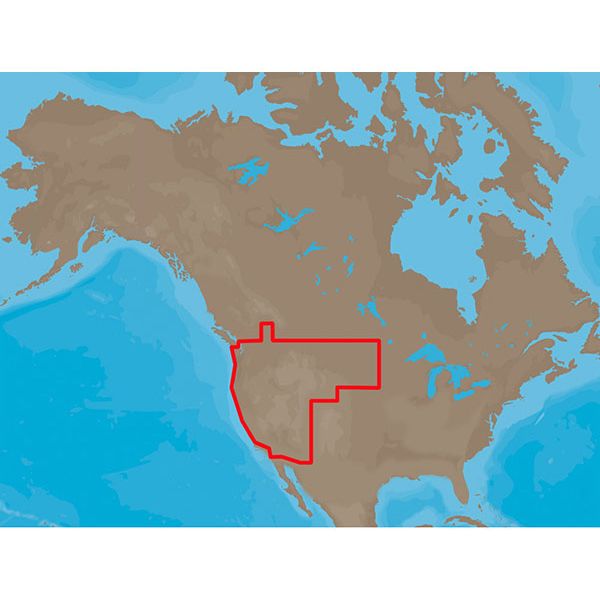
C-MAP MAX Lakes NA-M020 - Region 4: West - SD-Card Coverage:
Includes coverage for 700+ lakes in California, Arizona, Utah, Nevada, Wyoming, South Dakota, North Dakota, Montana, Idaho, Oregon and Washington.
River coverage includes the Missouri River from Lewis & Clark Reservoir, SD/NE to Lake Sakakawea, ND, Sacramento and San Joaquin Rivers, CA, Columbia River, WA/OR, Snake River, WA/ID and the Willamette River, OR.
C-MAP MAX Lakes Features:
- Shaded Depth Areas
- Points of Interest (POIs) such as campgrounds, shops, gas stations & more
- State Fishing Regulations
- State Hunting Regulations
- Fish Identification Photos
- Water Fowl Identification Photos
- Interstate Highways, Secondary and Lake Roads
- Boat Ramps
- National Parks and Recreation Areas
Show off your fishing gear investment. Please post images and videos of your fishing gear, apparel, catches and lifestyle shots on and off the water. Let's see what you've got for a chance to win FREE gear! You can use #HookedOnTD or UPLOAD YOUR IMAGE HERE to make it onto our product pages or gallery. See something you like? You can shop directly from the images we post when gear we sell is featured!


